Friday, November 23, 2012

The Deceptive Iztaccihuatl

Last Friday I left Guadalajara at 4pm after spending four days with 90 sixth graders at a camp outside of Guanajuato. I was tired, but I knew that one of the other two teacher/climbers would be able to drive the 7 hours to Mexico City. Scott and Swiggum were excited to have their second chance at a big mountain after last year on the Pico de Orizaba.

Iztaccihuatl from the Paso de Cortes
In D.F. (Distrito Federal a.k.a. Mexico City) we stayed in La Condessa, one of the hip neighborhoods. We enjoyed our last hours of civilization before driving from 7,500ft in D.F. up to 12,200ft. 12,200 ft is the elevation of the Paso de Cortes. In 1519 Hernan Cortes and his conquistadors crossed here between the volcanoes of Iztaccihuatl and Popocatepetl to get their first look at the lake of Tenochtitlan, the capital of the Aztec empire and soon to be capital of New Spain.

Sketch of the west side of Iztaccihuatl
Without anywhere to stay the nice people at the visitor center let us camp out for the next two nights on their floor for 2 dollars a night. We spent the next day acclimitizing to 12,000 ft and above by hiking around the foot hills of Iztaccihuatl, the Nahuatl word for 'white woman'. Iztaccihuatl looks like a sleeping woman from the west or east. In fact, the names of the climbing routes and features refer to the anatomy of the sleeping woman.

Sleeping in the visitor center at the Paso de Cortes (12,200ft)
On Monday morning we set out from La Joya (12,800ft) to the Refugio (a shelter built about 30 years ago by the Grupo de los Cien climbing club of D.F.). We carried all our food, water, sleeping supplies up to 15,500ft to stay the night with the plan of summitting the following day. As the night fell at the Refugio we ate tuna sandwiches for dinner and set up our sleeping bags in the silver lunch box shelter.
The Refugio 'El Grupo de los Cien' at 15,500ft
Ascending just outside of La Joya
Near the Portillo before Los Pies (the feet)

As soon as I laid down for sleep I began feeling signs of AMS (Acute Mountain Sickness). My head started pounding, my body was gripped with extreme nausea and spinning, and overall weakness. I knew that if we went down it meant the summit would be out of the picture for me and Scott and Swiggum. I also knew I couldn't risk going up any further. I laid there for another 2 hours and the symptoms continued to worsen. This was only the second time I had experienced AMS, the first time was on Mt. Hood 3 years ago.

At 9pm the decision was made to go down. We picked our way back down from the Refugio back down to La Joya using the light from our headlamps. Back down at 12,800ft I immediately began to feel better. We slept for 5 hours in the car and then descended down to the town of Amecameca at the base of the volcanoes.

We were tired and defeated. There was a sense of disappointment among us and I felt guilt for being the reason we had to descend. We checked into a hotel in Amecameca and began pondering our options. I had no intention of returning to Guadalajara being utterly defeated. So I threw out the idea of going for a single push for the summit on Thursday. The guys looked disgusted. We had just spent three restless nights up there. Scott, a intense athlete, responded that if we went up Wednesday, meaning no sleep at low altitude, he would do it.

View of Iztaccihuatl from our hotel in Amecameca
The decision was made that Scott and I would attempt a single push for the summit at 2am Wednesday morning. So we rested a couple hours in Amecameca and drove the Geo Prizm back up to La Joya for the night. That night we watched 'Lars and the Real Girl' on Scott's iPod before sleeping for five hours in the car again for our early morning wake up.

My watch alarm woke us up at 2am and we threw on our clothes and packs and started trudging up and waiting for the sun to hit us. We reached the Refugio at 15,500ft by 5am. The sky was still black and the stars shined brightly above the city lights from Mexico City to the west and Puebla off to the east. We gathered ourselves and then began the ascent of Las Rodillas (the knees). Las Rodillas was a time consuming class 2-3 rock climb to 16,300ft. Scott, having never done any rock climbing before, felt extremely exposed through this section.
Pico de Orizaba at sunrise
Popocatepetl erupting beyond the Paso de Cortes

The sun hit us about 20 minutes from the summit of Las Rodillas. Popocatepetl began throwing out puffs of black smoke as the sun lifted from behind Pico de Orizaba out in the distance. The orange sunrise gave us new energy as we arrived at the top of the knees and looked out at the arctic landscape in front of us.

Crossing the Glacier de Ayoloco
From Las Rodillas there are 3 hours of traversing, ascending, descending amongst snowy ridges, glaciers, and steep rock faces. We crossed La Barriga (the belly) which contained the melting Glacier de Ayoloco. The mix of climbing forced us to put-on and take-off our crampons 3 times before attaining the summit ridge (La Arista del Sol) near 17,000ft. The summit (17,180ft) turned out to be a snow bowl with three separate 'summits'. We picked the one that appeared to be a meter or two taller than the others and lethargically trudged onwards.
The summit (17,180ft), El Pecho (the breast), third tallest mountain in Mexico (Orizaba is tallest, Popocatepetl is second)

At the summit we snapped a couple photos, hugged, and then began the long descent back. As we came back down Las Rodillas the clouds began rolling in from the east like clockwork at noon. We carefully worked our way down the section traversing Los Pies (the feet) and back down to La Joya. We reached the car at 3pm, making the entire day a 12.5 hour day with very few breaks.
Scott and Sam at summit overlooking La Cabeza (the head)

A 3.5 minute video from climbing Iztaccihuatl: YouTube link for Iztaccihuatl from Guadalajara


Saturday, November 3, 2012

E=mc2 for Dia de los Muertos

Sugar Skeletons
Just got back from an eventful and interesting Day of the Dead in Patzcuaro, Michoacan. The distinctly Mexican holiday has been taking place in Patzcuaro for 100s of years. The night we arrived (November 1st) we headed out to Janitzio, the island town in the middle of Lake Patzcuaro. I was expecting a sobering procession of grieving and honoring the dead. What we found instead was a big Mexican fiesta, complete with tequila, beers, jarros locos, and plenty of delicious food. At first I thought that this was completely disrespectful to the dead people. Slowly I began to realize that the fiesta was the tradition to honor and celebrate the dead.

Candles on Janitzio


The island and cemeteries in and around Patzcuaro were packed with people. A few were adorning graves with colorful flower displays and pan de los muertos. Most were armed with cameras taking photos of the process. It was difficult to walk without stepping on graves. The party went on and on until the morning. Even at our campsite outside the city we could find no peace as music blasted until 7am.
Catrina Dolls
Church in Patzcuaro

My school celebrated both Halloween and Dia de los Muertos together on November 1st. I've never seen such a huge Halloween party. All the grades (K through 12) were in costume and parents came to school to watch a parade. In every classroom the 'room mothers' set up elaborate spreads of festive food for the kids and teachers to eat. All in all a very fun day.
Albert Einstein- "I miss my beard!"

Tuesday, October 9, 2012

Back to School

The start of another school year has come and gone. I feel like I've already been teaching for months. The new 6th graders are fantastic and now I get to just be friends with the 7th graders. And with the beginning of each year comes the middle school movie. This year I was caste for one of the major roles- a teacher/rock star. The director put in over 100 hours all while completing the duties of an 8th grade social studies teacher... very impressive!

Enjoy! Click on the link:

Middle School Rock and Roll
The password is black.

The San Juan Cathedral. The last thing standing in the wake of the 1941
birth of Volcan de Paricutan in the mountainous state of Michoacan.

Descending into the lava filled church.

October 6, 2012 Ascending the 9,186ft high Volcan de Paricutin.

A total of 7 hours on horseback in order to reach the Volcan. My
lower back and gluts have never been so sore.

Cheran, Michoacan. My friend, Scott, is shooting a photo story here. The town finally had enough when they tried to stop clear-cutting in their forests. The police and federales initially did nothing to help, and the narcos, 'La Familia', were supporting the clear cutters. So the townspeople kicked out the narcos and the police, took their weapons, set up barricades at every entrance and said, "fine, we're going to do things our own way." An inspiration to all of Mexico.
Una fiesta en Cheran, Michoacan.

At the summit of the Nevado de Colima again 4340m (14,240ft)
September 29, 2012, my friend Charlotte's birthday.


Monday, May 21, 2012

Attack of the Ticks

 School is nearly out; the tiniest faint light is beginning to appear at the furthest end of the tunnel. The kids think the light is right in front of them... and we're still 5 weeks away. That's a long time with 105 checked-out 12-year-olds. I've been doing as much student led activities as possible. Right now were designing simple machines using Google SketchUp in the computer labs. They love and I get to feel like I'm in the middle of an Architecture studio running around.
 Pinta the puppy

Another fine weekend relaxing at the beach. Two friends and I camped out on one of our favorite (not as much anymore) surf spots. La Caleta is a inhabitantless beach a fifteen-minute boat ride from the nearest town. Except for one old man who has lived there alone for 40 years. From what we gather, he was fed up with life in his hometown of Las Varas and packed up and moved to a deserted beach.
La Caleta on a better weekend---

This past weekend there happened to be some of the smallest, slowest waves we'd seen in a while, so we lounged around the beach with the puppies and chickens that belonged to Juan (the hermit). After a day of PB&J we decided to explore a trail that led to nearby Chacala. Juan informed us that the walk took about an hour. The sound of a juicy steak burrito could not be resisted.

We took of down the trail sweating as the jungle sun beat down through the canopy. I was sweating profusely and attracting all kinds of bug life. I batted at mosquitoes with my shirt while trying to fan myself at the same time. This hike seemed to be taking forever and was becoming increasingly uncomfortable. Was this really worth a burrito I thought? It was at this moment that I glanced down at my itchy legs to see what appeared to be freckles. I stopped to find that the luckily I hadn't grown new freckles, but instead was covered in ticks. Probably over a hundred of them were swarming up my legs and underneath my swim trunks.

I screamed out to my friends and they stopped to find themselves in the same predicament. The three of us stopped dropped our shorts where we were and began the process of removing every tick we could see. All the while I was hopping around yelling in discomfort and terror. We removed a good 50 each and then ran towards town and the ocean. I sprinted through all the people into the Pacific hoping the ticks would drown.

They didn't. We sat down for burritos and spent the next hour removing and killing ticks. Now I'm just hoping there's no crazy tick diseases down here.

A video test for my new 1st person camera at La Ticla, in Michoacan

Sunday, April 22, 2012

El Estado Libre y Soberano de Aguascalientes

 El estado libre y soberano de Aguascalientes-- the Free and Sovereign State of Aguascalientes lies only a few hours to the north of Guadalajara. One of the smallest states of the 32 states in Mexico, Aguascalientes has fought for its own independence from neighboring state Zacatecas since before Mexico was even a country. Finally in 1857 it became it's own state.

As the name suggests there are some hot waters to be found in the capital city of Aguascalientes. Los banos termales de ojocaliente are in a building from 1808--over 200 years old! Courtyards, flowers and beautiful architecture make this experience like no other hot spring I've ever been to before. Each of the private bath rooms were dropped into the earth and steamed at around 40 degrees Celsius. A wonderful place.

Aguascalientes is full of other surprises including the Museo Jose Guadalupe Posada-the artist you gave wake to the likes of Diego Rivera and Jose Orozco. The museum was incredible and housed the most notable piece of Posada's work the Catrina block print.


The most surprising part about Aguascalientes is how few tourists seem to make it here. It's only a few hours from Guadalajara and I haven't met anyone who's taken a trip to this beautiful city.

Monday, April 9, 2012

Barrancas o Bust


After a couple months in the planning, the short trip to the Barrancas del Cobre, Sierra Tarahumara, or El Chepe is complete... for now.

We started in Culiacan on a morning Vivaaerobus flight from Guadalajara. After a quick ten minute taxi ride from the airport to the bus station we ran in to find a bus to Los Mochis. Buses leave for Mochis every 20 minutes supposedly. I knew that Los Mochis wasn't worth a night's stay from passing through last October.

In typical fashion, the TAP bus was over two hours late (we already paid for tickets, so me storming around scolding TAP employees did little to help us). Luckily in Mochis we caught the last bus to El Fuerte.


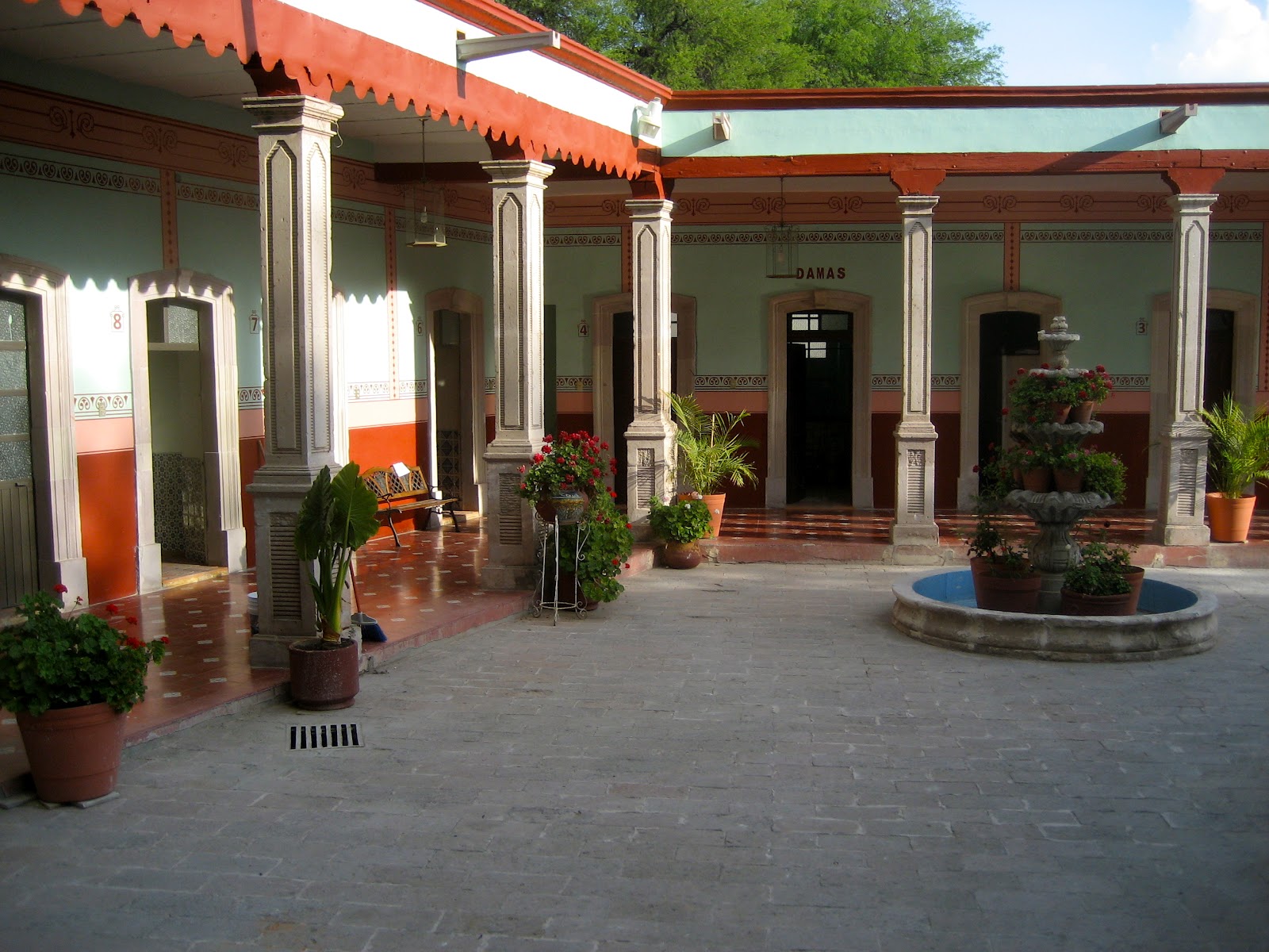
In El Fuerte we stayed at the Hotel Posada Don Porfirio (460 pesos). An enchanting little place a block from the plaza. Otto, the owner, was extremely helpful and pointed us in the right direction for good eats and sights close by.

Early the next morning we boarded El Chepe (the train). Only the first class train was running that day, so we had no choice but to cough up 600 pesos each to get to Bahuichivo. Expensive, but worth it! We sat near the back and had nearly the whole train car to ourselves. I spent much of the ride on the back overlook shooting video and taking pictures.


In Bahuichivo the touts met us as soon as our feet hit the ground. One ride to Cerocahui for 40 pesos, another for 75 pesos, another ride to a lodge 5 km outside Cerocahui. We combined forces with three other European backpackers and took a Suburban to the Francia Valenzuela Hotel in Cerocahui, within rock throwing distance of the old church.

When in Cerocahui and hiking to the waterfall, remember to follow the arroyo! Try not to get side tracked by the roads that appear to be going in the same direction as the arroyo. We got lost and wandered our way to the top of a hill without seeing a drop of water along the way. In hindsight, it's a good bet the waterfall was just as dry!


KAYAKING POSSIBILITIES:
None of these dry creeks near Cerocahui appeared particularly runnable. I started asking around about the boating (whitewater) season and little information is out there. In Creel, you can buy INEGI topo maps, similar to 7.5" quads from USGS, although they're 100 pesos a piece (INEGI is Mexico's version of the USGS). Rocky Contos has the most information on the area available at his website (sierrarios.org) for a $35 membership. That seems to be about all there is.

Everyone I asked confirmed that the rainy season starts sometime in June and ends sometime in September. The best months probably being July and August. I also talked to people about the road conditions. The consensus seemed to be that roads remain good through the rainy season (there is an extensive system of unpaved roads in the region).

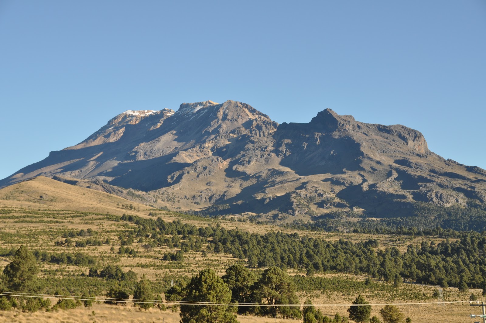
The most impressive glimpse of a multi-day, runnable river was from El Mirador. The Mirador is the classic Barrancas del Cobre shot, overlooking the mighty Urique River (which contains water even in the midst of the dry season). It has been run before (at least by one person), but remains largely unknown to the whitewater community for being in a canyon deeper than the Grand Canyon of the Colorado.

Besides the Urique R. there are numerous other rivers carving out the Sierra Tarahumara. This large uplifted volcanic plateau probably possesses the world's largest proliferation of deeply incised canyons in such a small area. From the train you start to get a feel for the scale of these canyons and the unknown that has yet to be explored...and kayaked.


Gordita shot with my new 35mm, 1.4 F-stop lens.


THE HOSPITAL IN CREEL:

Creel will be remembered for me as the place I became the most ill I've been to date from Mexican cuisine. After an exciting day of watching a reenactment of Christ being crucified all over town (we visited during Semana Santa) we relaxed at a nearby hot spring in Rekowata. We sampled some carne de res seco (dry meat). It tasted rancid and it's effects proved to be even worse.

The next morning I awoke to excruciating pain in my sides and began vomiting...violently, over and over. In the next six hours I made over 20 trips to the bathroom with stuff coming out of both ends. Caitlin decided it was time to see a doctor (she had made the wise choice of spitting the dry meat out).

The taxi driver looked like he'd seen a ghost as I stumbled aboard his Toyota pick-up. The clinic was only two blocks away, but it was all I could do to half-way button up my shirt and clamor outside the hotel room.

At the clinic a team of four nurses helped me into a medical cot and started firing away questions. Although I was nearly incoherent from severe dehydration I managed to ramble out short replies. Then came out the IV. It would have been scary in the most modern hospital on Earth; I hate needles. Add needles to med equipment from the 1940s and stains of unknown bodily fluids on the floor and you've got a scene from the Texas chainsaw massacre.

As I squirmed and sweat beaded down my face the nurse stuck a needle in my hand. It didn't take. She moved the pressure thing up to my bicep and stuck the needle in my elbow armpit. I trembled in discomfort and from chilling cold. It felt like I was out in snow with no clothes on and the vertebrae in my spine were icing up. The nurses ran all over the clinic collecting blankets for me all the while asking Caitlin how old I was (a testament to my fear of needles!)

When it was all over about an hour and half later I felt slightly better. All said and done the bill came to 238 pesos (about 18 dollars), including four boxes of medications (which I'm still on). I rested the remainder of the afternoon before escaping to Chihuahua the next day. Ay Chihuahua!!!

Here's the youtube video of some of the clips compiled together:

Barrancas del Cobre por Tren

Wednesday, January 11, 2012

All Signs to Saltillo

There's something funny about driving in Guadalajara; or driving in Mexico in general. Most days I want to drive to a restaurant, a bank, or on the weekend a nearby town. I back out of the drive with a clear vision of a map that I've studied. I know exactly where I want to go.

And then the inevitable happens... I get lost amongst the winding and free-form streets of Mexico and resort to looking for signs. I look up and the only signs available are for places far away, like Nogales (Arizona), Mexico City, or Colima (250 km south). And then there's always the sign for a city I've never wanted to go to, Saltillo. There are so many signs for Saltillo that I've had to look it up. It's the capital city of the state of Coahuila nearly 700 km away. I curse to myself and remember what I'm looking for. I just want to go to the bank, or that new pastor taco joint, or I just want to El Diente and climb. My eyes search for street signs while dodging countless potholes and elote carts. You can go for blocks without seeing a street sign, but in those same blocks you may see three signs for Saltillo.

So I'm convinced there must be something absolutely amazing in Saltillo. A fountain of youth, clean streets paved in gold, and free beer. Why else would there be this many signs?

On Monday I started my Masters in International Education at Framingham State University in Massachusetts. My first online course is Creative Teaching Techniques & Utilization of Multimedia. One of the first assignments was to create a mock teacher website on Shutterfly.com, so here it is. There's a good photo graphical description of what we've done so far with the fish pharaoh project if you're interested.

Mr. Sam's 6th Grade Science Shutterfly Homepage

Here are just a couple photos from my trip to Mexico City and Oaxaca over Christmas break:


Teotihuacan Ruins


Frida Kahlo's Blue House


Oaxaca City